Well, we started the year off with a geography block. I thought it would be nice to start off the year with a block that we could all do together. Unfortunately, the kids moaned and groaned a lot during these past five weeks but I am not sure it was because of the material. I think it had more to do with starting school when it is still so beautiful outside.
We worked together most days but each child had their own projects. The block looked a bit like this.
Week 1: The first week, we looked at how animals use their senses to get to places such as migrating birds, eels, salmon, bees, etc. We then moved on to maps and mapmaking.
- Two of the books I used to plan the block
Week 2: This week we looked at how the children view the world. We also learned about Ptolemy and his way of using lines of longitude and latitude to map areas on a map.
- Parks’ view of the world.
- Using Clay to make a map.
Week 3: Week 3 allowed us a little more time to be hands on with geography. Parks took and orienteering class at Latta Plantation Nature Center where they learned the parts of a compass and how to use the compass to find markers out in the woods. During his class time, I sent Sims and Sawyer out to map a trail. From the map that they made, they learned the importance of using a standard unit of measure as Sims’ steps were very different from Sawyer’s steps so they ended up in different places. The week ended with Sims taking an Adventure Journaling class at Latta where he learned about the adventures of Louis and Clark and how they wrote an adventure journal and used the compass in their journey. Sims’ and Parks’ classes have a few more meetings through the season so they will continue their learning of geography throughout the semester.
- Sawyer following Sims’ Trail Map
- Compass Lesson-Orienteering
Weeks 4 and 5: The last two weeks had everyone working a little more independently as they each studied a different area. Sawyer is in the fourth grade so she is researching NC geography. Sims chose England, and Parks chose Puerto Rico. Throughout the last two weeks, they worked on area maps, topographical maps (both on paper and 3D) and geographical areas of interest to them. The past two weeks were fun to watch as they pieced information together such as how most large cities are near water or on a trade route. They also enjoyed tracing the rivers and looking at how they flowed over the land. We have really lucked out with the classes being held at Latta Plantation this session. Sawyer is taking a class called Catawba Studies in which they are looking at how the Catawba Indians lived on the land and use the natural resources of NC.
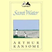
Today, we also finished up our read aloud book called Secret Water by Arthur Ransome. The book is an exciting tale of four children who are “marooned” on an island and must map the island before they are rescued. The best part of the block has been the many ways that geography and cartography have entered our worlds over the past few weeks. Sawyer read Dragon Rider which had a cartographer as a character in the book. Sims is reading The Knighting of Sir Kaye which speaks of mapping the forest. And Parks is now actually looking at maps and trying to figure them out.


This makes me smile because I hate reading maps! My husband adores them. I drive. He navigates. Works well enough! Such hands on activities! Kudos!
LikeLike
I never liked maps before either but this time I found them fairly fascinating. I never realized how important maps are in telling a story! Yes, I had to do some hands on. Otherwise, they were not interested. LOL..
LikeLike
Pingback: Local History Blocks-North Carolina | Simple Days Make for an Exciting Adventure